Jotunheimen National Park Hiking Guide
A complete guide to hiking Jotunheimen National Park with detailed routes, practical advice and the best times to visit Norway's iconic mountain region.
Quick links
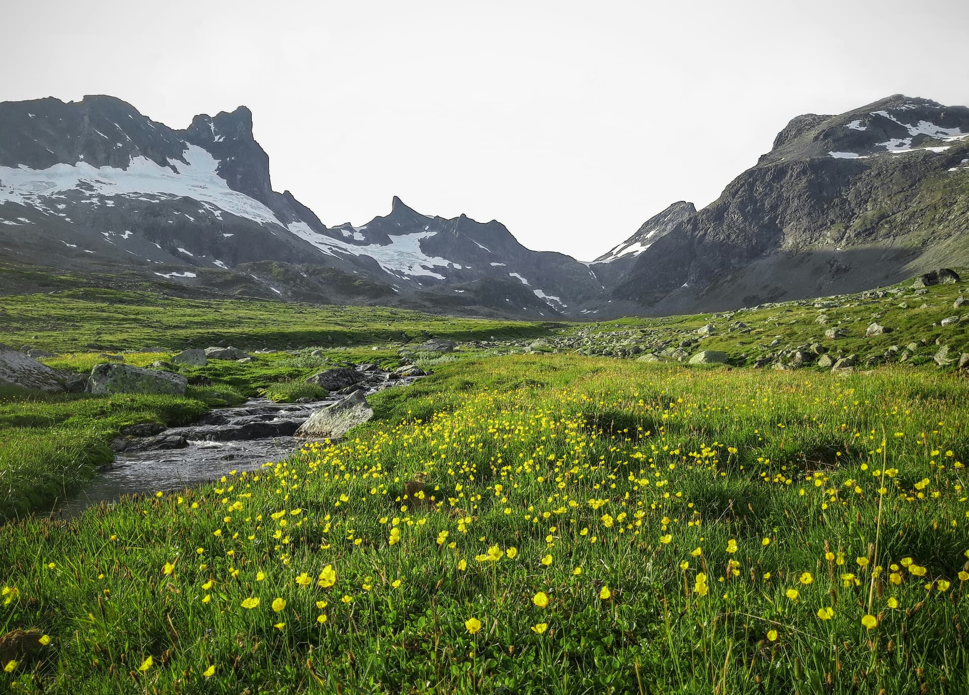
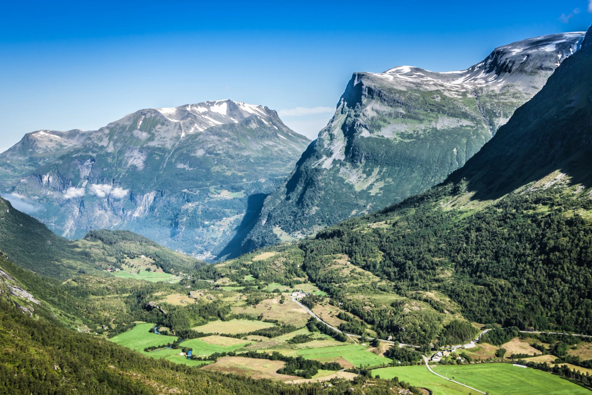
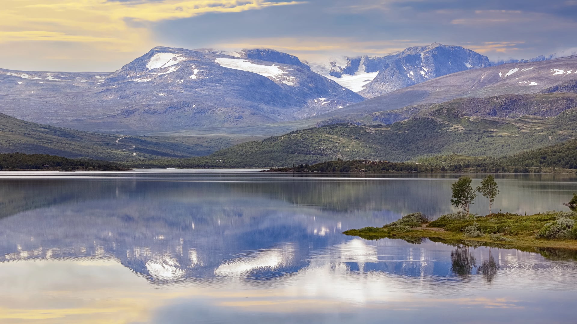
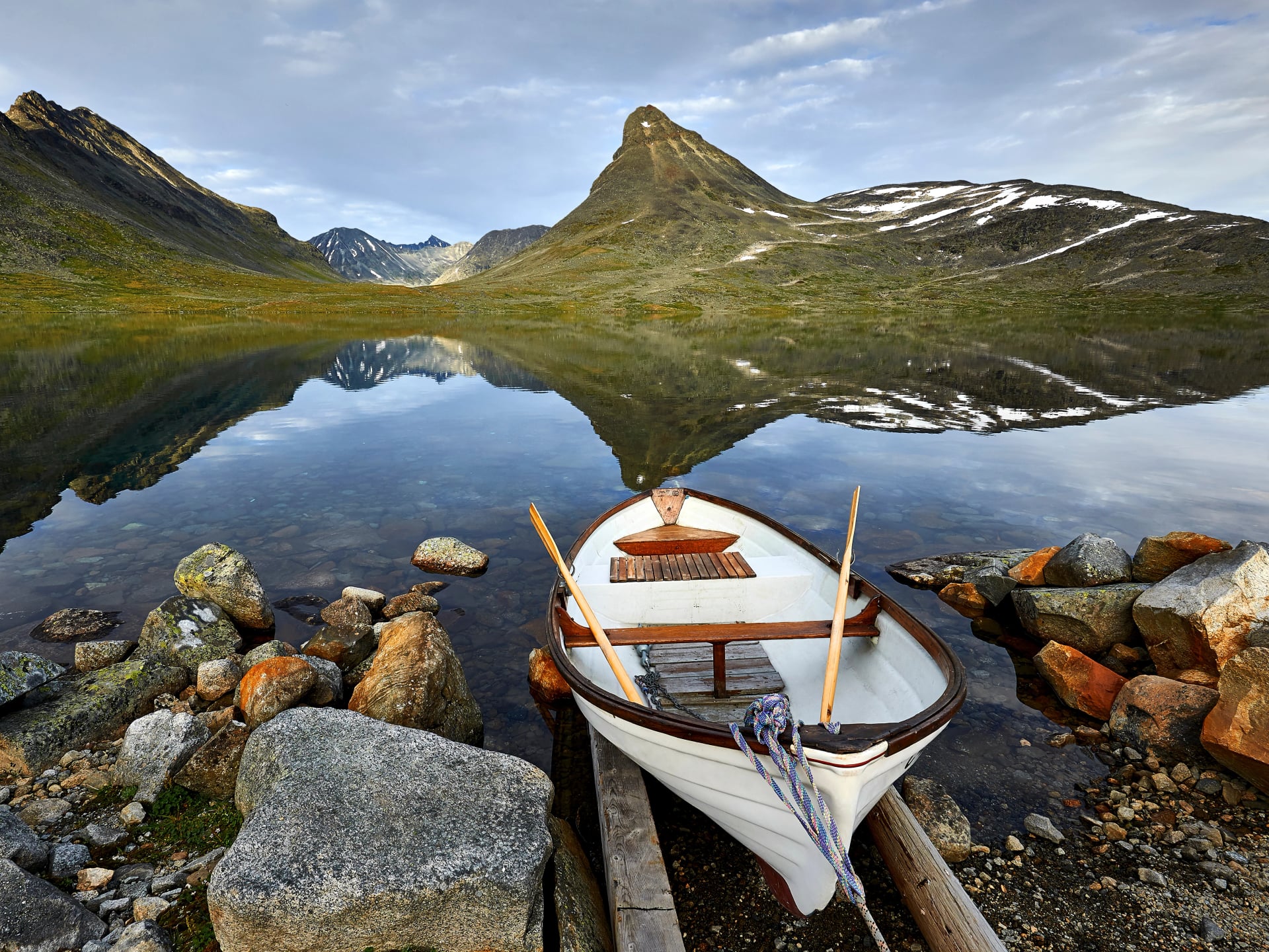
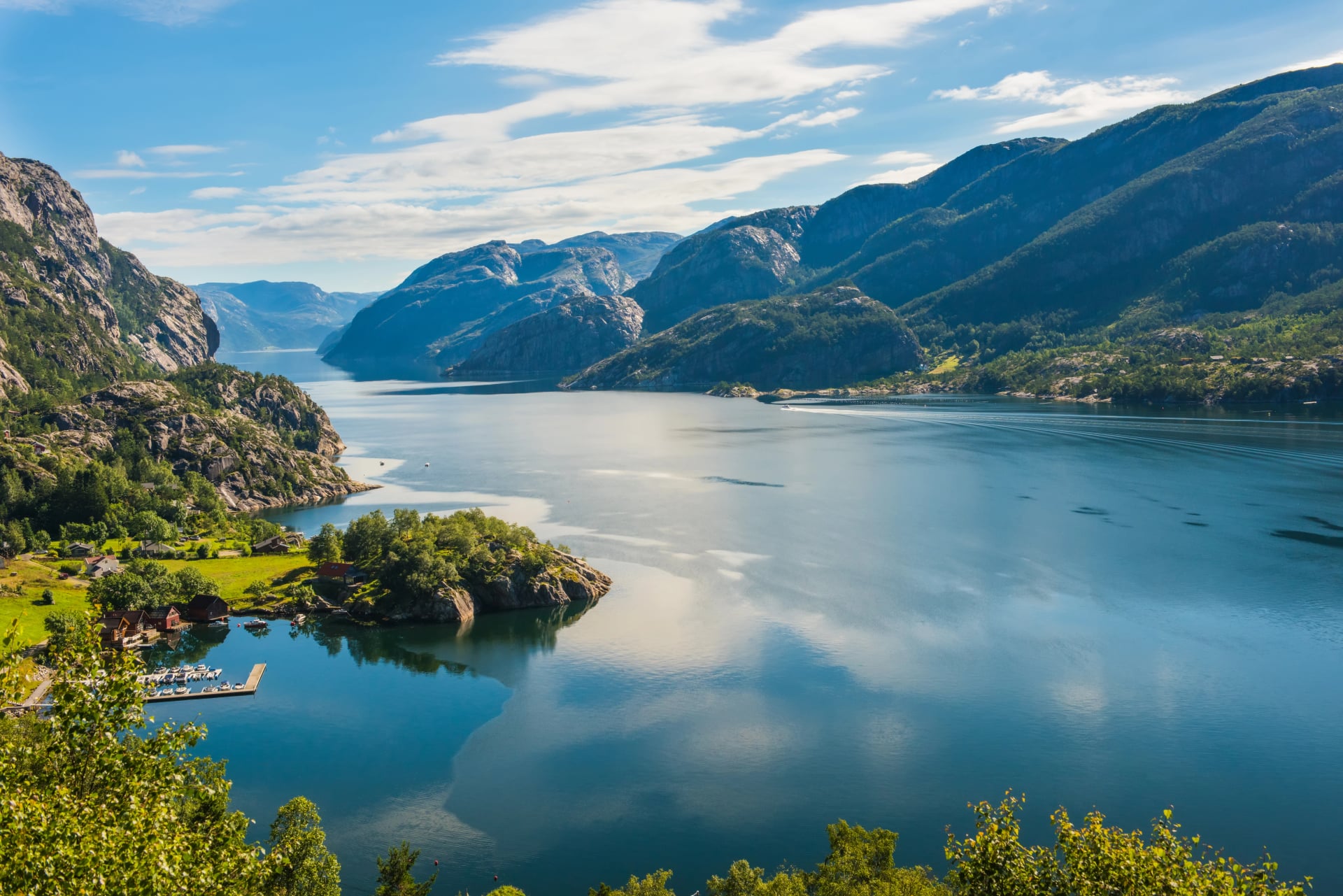
Jotunheimen National Park sits in the heart of southern Norway and lives up to its name as the "Home of the Giants." This is Norway's most dramatic mountain region, containing the country's highest concentration of peaks above 2,000 metres, including Norway's two tallest summits: Galdhøpiggen (2,469 m) and Glittertind (2,465 m).
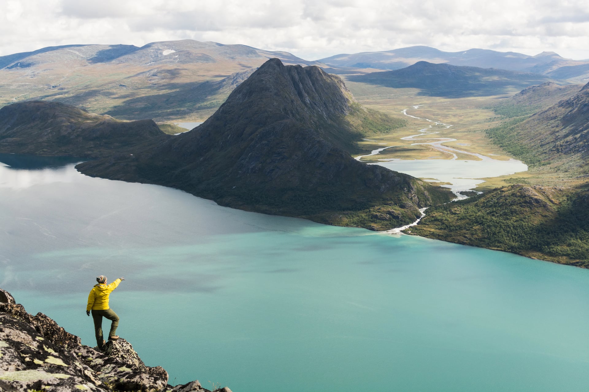
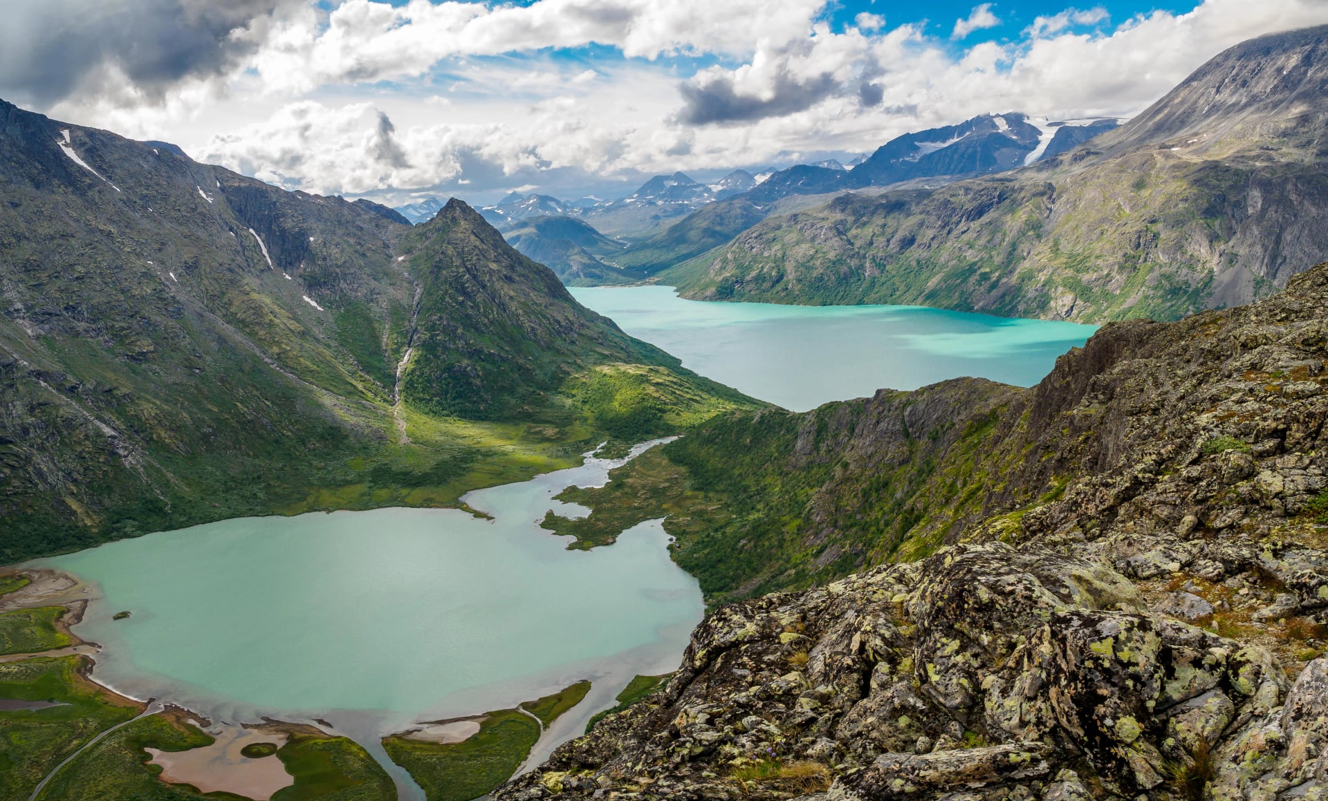
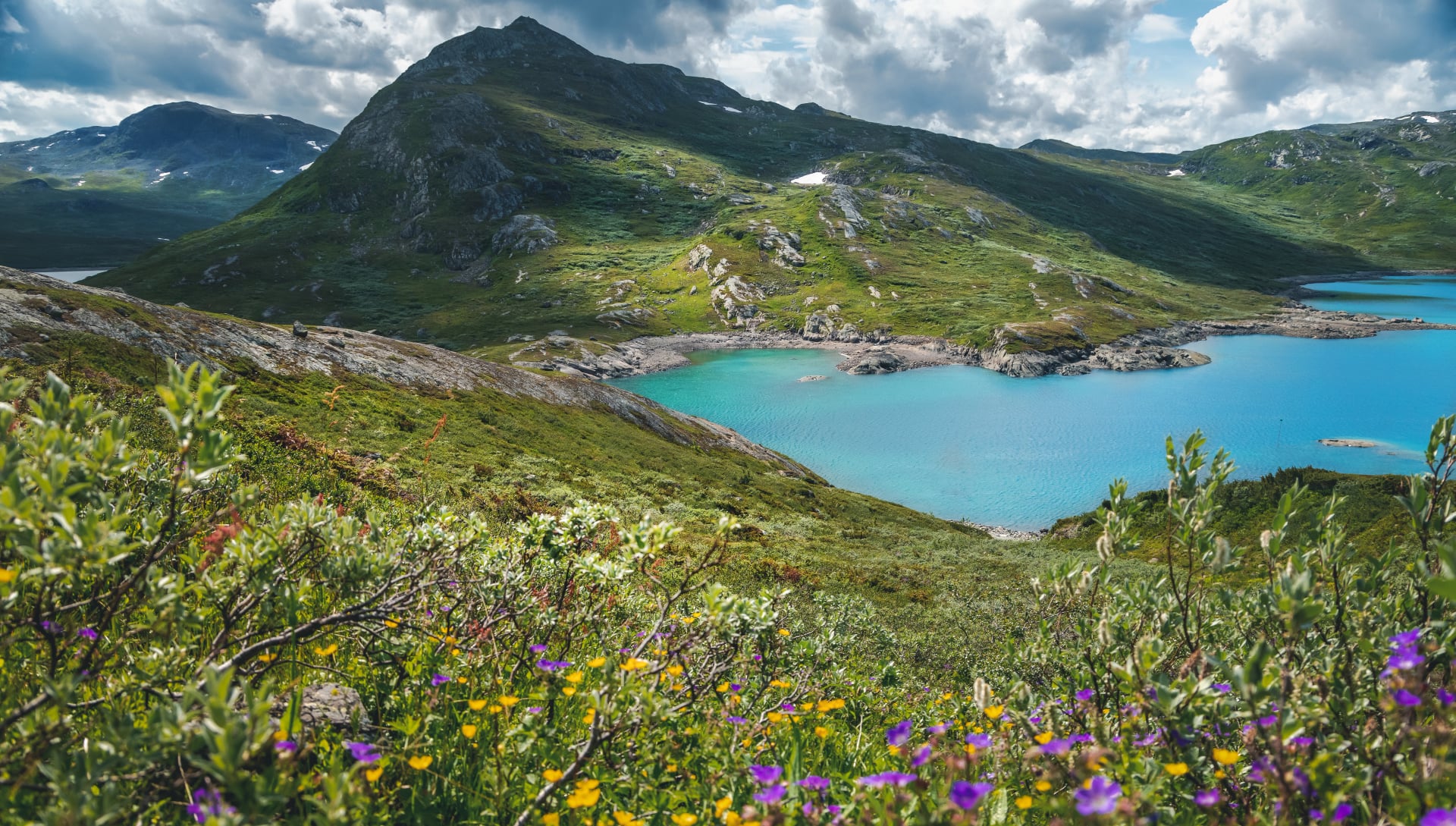
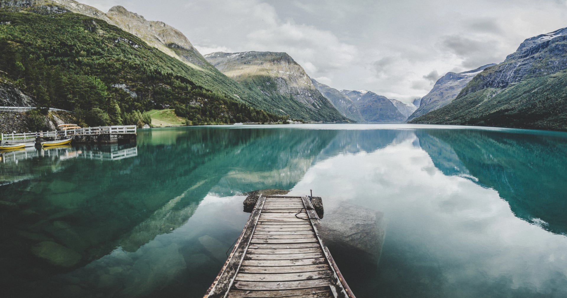
The park became world-famous through the Besseggen Ridge, one of Scandinavia's most iconic hikes, where turquoise and deep-blue lakes create unforgettable views from a knife-edge ridge. Beyond Besseggen, Jotunheimen offers jagged peaks, active glaciers, and pristine alpine valleys that define Norway's mountain character.
Many spectacular viewpoints are reachable on day hikes, and the extensive cabin network makes multi-day routes accessible even for hikers who don't want to camp. From first-time mountain hikers tackling Besseggen to experienced trekkers summiting Norway's highest peaks, Jotunheimen delivers genuine alpine experiences in Europe's premier hiking destination.
About Jotunheimen National Park
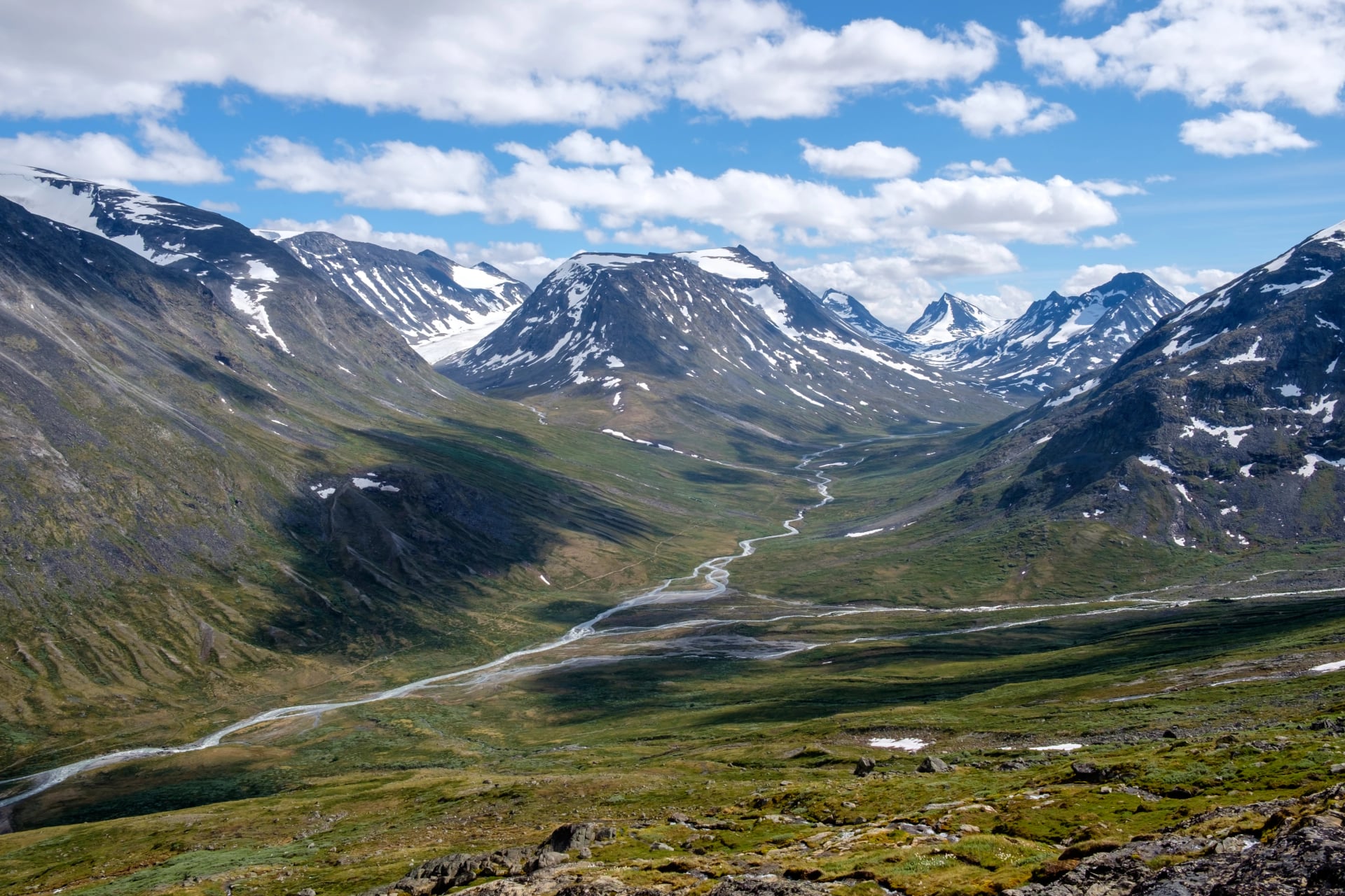
Hikers come to Jotunheimen for Norway's most dramatic alpine scenery. The park covers more than 1,150 square kilometres with the country's highest peaks, glaciers, knife-edge ridges, and turquoise alpine lakes. Well-developed trails connect traditional mountain lodges, making serious alpine hiking accessible without camping gear.
Key facts at a glance:
Location: Innlandet & Vestland counties, Norway
Established: 1980
Highest peaks: Galdhøpiggen (2,469 m), Glittertind (2,465 m)
Landscape: Glaciers, ridgelines, cirques, deep valleys, alpine lakes
Trails: 300+ km of marked routes and maintained trails
Wildlife: Reindeer, arctic fox, ptarmigan, golden eagle, alpine flora
The park has dramatic mountain architecture but remains surprisingly accessible with lodges, ferries and marked paths that work well for moderate hikers.
What Defines Jotunheimen as a Hiking Destination
Jotunheimen combines the accessibility of Norway's southern mountains with wild alpine atmosphere at high altitude. Sharp ridges rise above glacier-carved valleys, vast plateaus stretch between peaks, and routes link mountain huts for both short stays and multi-day treks.
You can explore for a weekend or spend a full week trekking across the park. Jotunheimen delivers big mountain scenery, crisp air and expansive views.
Why Hike Jotunheimen National Park
Jotunheimen offers serious alpine terrain without extreme remoteness. The park has Norway's two highest peaks (Galdhøpiggen and Glittertind), famous ridge walks like Besseggen, and over 60 peaks above 2,000 meters. This is more concentrated high-altitude terrain than anywhere else in Scandinavia.
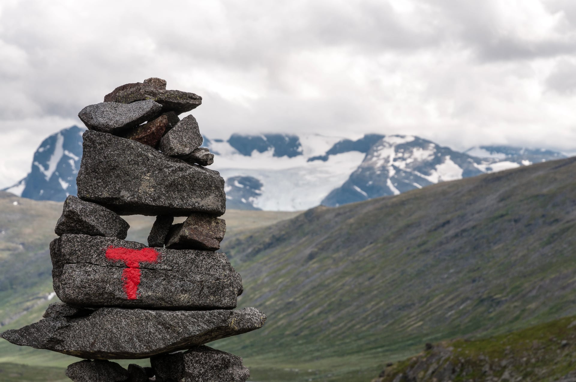
The well-developed hut system means you can tackle challenging routes without carrying camping gear. Ferries across Gjende lake connect trails for point-to-point hikes, and marked paths make navigation straightforward even in challenging terrain.
Weather is more stable than coastal Norway, with better chances of clear summit days. The landscape is genuinely alpine with glaciers, snowfields, and sharp ridges. This gives you a high-mountain experience that's rare in northern Europe yet accessible for strong hikers.
Jotunheimen vs Other Norwegian Hiking Destinations
If you're planning a hiking trip in Norway, Jotunheimen is one of several good options. Each mountain area offers different terrain, challenge levels and accessibility.
1. Jotunheimen National Park
Norway's premier alpine region. The park has high peaks, glaciers, dramatic ridges and long valleys with some of Norway's most spectacular scenery. Trails range from straightforward hut-to-hut routes to serious summit ascents. Best for hikers who want significant elevation, iconic viewpoints and a classic high-mountain experience.
2. Rondane National Park
Rondane is older, quieter and more rounded. The peaks are gentler and less technical, making it good for calmer landscapes and easier routes. It lacks Jotunheimen's dramatic ridges but offers more peaceful highland hiking.
3. Hardangervidda Plateau
Hardangervidda is the largest mountain plateau in northern Europe. Wide, open tundra dominates the landscape, and hiking here feels remote and wild. It doesn't have Jotunheimen's towering peaks, but the vastness is unmatched and works well for long-distance trekkers.
4. Lysefjord & Southwest Norway
Trails like Kjerag and Preikestolen offer dramatic fjord scenery and steep cliffs, but the region is coastal, wetter and much lower in altitude. These routes work well for day hikers but don't offer the alpine experience that defines Jotunheimen.
Quick Comparison
Destination | Duration | Elevation | Difficulty | Best For |
Jotunheimen | 2–7 days | High | Moderate to very hard | Alpine peaks, big scenery, classic routes |
Rondane | 2–6 days | Moderate | Moderate | Quieter mountains, gentler summits |
Hardangervidda | 4–10 days | Low to moderate | Moderate | Long-distance crossings, wide-open landscapes |
Lysefjord region | 1 day–3 days | Moderate | Easy–hard | Fjord cliffs and short dramatic hikes |
For a short, powerful alpine experience that combines classic peaks with a well-developed hut system, Jotunheimen is the best choice.
When to Visit Jotunheimen National Park
The main hiking season runs from late June to late September, when snow has melted from most trails above 1,500 metres and mountain huts are open. Temperatures typically range between 12°C and 20°C in valleys, with high routes at 5–12°C.
Early July to mid-September is the most stable period for high-altitude routes and summits.
Below is what each season offers so you can choose the best time for your trip.
Spring (April–June)
Spring arrives late in Jotunheimen. Snow persists on high routes well into June, and most classic hikes remain closed until late June or early July. Valley trails and low-elevation approaches open earlier, especially on the eastern side of the park.
Temperatures: Valleys 5–15°C; high routes below 10°C.
Best for: Early-season hikers who want cool temperatures, quieter trails and snowy valley scenery.
Good to know:
Snow remains above 1,300–1,600 m until late June
River crossings are swollen with meltwater
June can be good but is still transitional
Summer (July–August)
Summer is the busiest and most reliable hiking season. Trails are fully open, lodges operate at full capacity, and ferries run daily. Days are long, mornings clear and visibility good. Afternoon showers or storms can occur but less frequently than in spring.
Temperatures: Valleys 12–22°C; high routes 6–16°C.
Best for: Classic ridge routes, summits, multi-day treks and families hiking main trails.
Good to know:
July and August are peak season in Gjende and Spiterstulen
Early starts recommended for popular routes like Besseggen
Snow may linger on Glittertind's summit
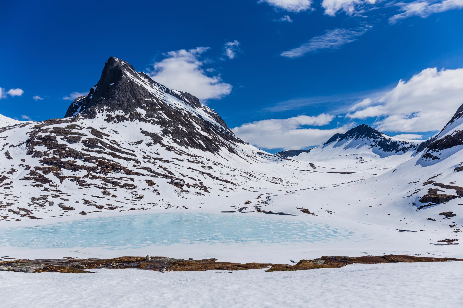
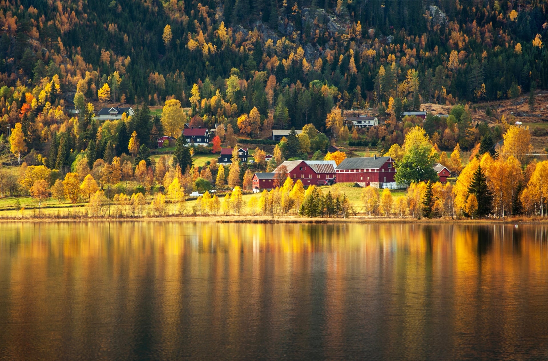
Autumn (September–Mid October)
Autumn delivers some of the best hiking conditions of the year. Crisp air, golden light and fewer people make September a favourite among experienced hikers. Trails remain open until the first snowfalls, often in early or mid-October.
Temperatures: Valleys 8–15°C; high routes 4–10°C.
Why go in autumn:
Stable conditions and superb visibility
Brilliant autumn colours in valleys
Fewer hikers and quieter huts
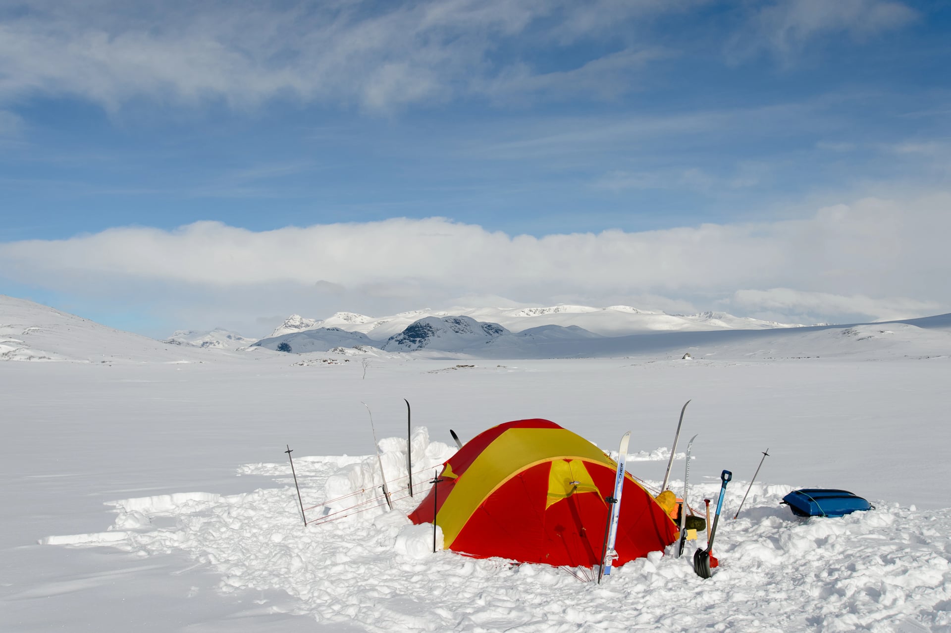
Winter (Mid October–May)
Winter transforms Jotunheimen into a ski-touring and mountaineering region. Snow covers all high routes, temperatures drop well below freezing, and terrain becomes technical.
Temperatures: Valleys –10 to 5°C; peaks extremely cold.
Best for: Experienced winter mountaineers — not suitable for normal hiking.
Good to know:
Snow and ice persist into late spring
Glacier travel requires equipment and training
Many roads and huts close for the season
What to Do in Bad Weather
Norwegian mountains have sudden weather changes. A clear morning can shift to rain, wind or whiteout conditions quickly, especially at higher elevations. If weather deteriorates, descend early or return to a lower, more sheltered valley.
Lodges such as Gjendesheim, Memurubu, Spiterstulen, Glitterheim and Fondsbu offer warm indoor spaces to wait out bad weather. Valley villages like Lom and Øvre Årdal have cafés, bakeries and small shops for rest days.
Where to Check the Weather
Weather can vary dramatically between valleys, ridges and peaks, so always check updated mountain forecasts.
Best sources:
YR.no — Norway's most reliable mountain forecast
Storm.no — Alternative model with good wind data
Varsom.no — Avalanche & snow conditions (important early/late season)
Windy — Excellent for wind, storm tracking and comparing models
Best Hikes in Jotunheimen National Park
Jotunheimen offers some of Norway's most iconic trails. From knife-edge ridges to glacial valleys and classic summit routes, there's something for every hiker.
1. Besseggen Ridge
This is Jotunheimen's most famous hike and one of Norway's most iconic ridge routes. The trail climbs from Gjende lakeshore up to spectacular views of Gjende and Bessvatnet, with contrasting turquoise and deep-blue waters creating one of the most famous scenes in Scandinavian hiking.
Distance: 13–14 km
Time: 5–7 hours
Elevation: +1,000 m
Difficulty: Moderate–hard
Most hikers take the ferry to Memurubu and return on foot to Gjendesheim, finishing the steep ridge descent rather than climbing it. Early starts avoid crowds and offer the best lighting.
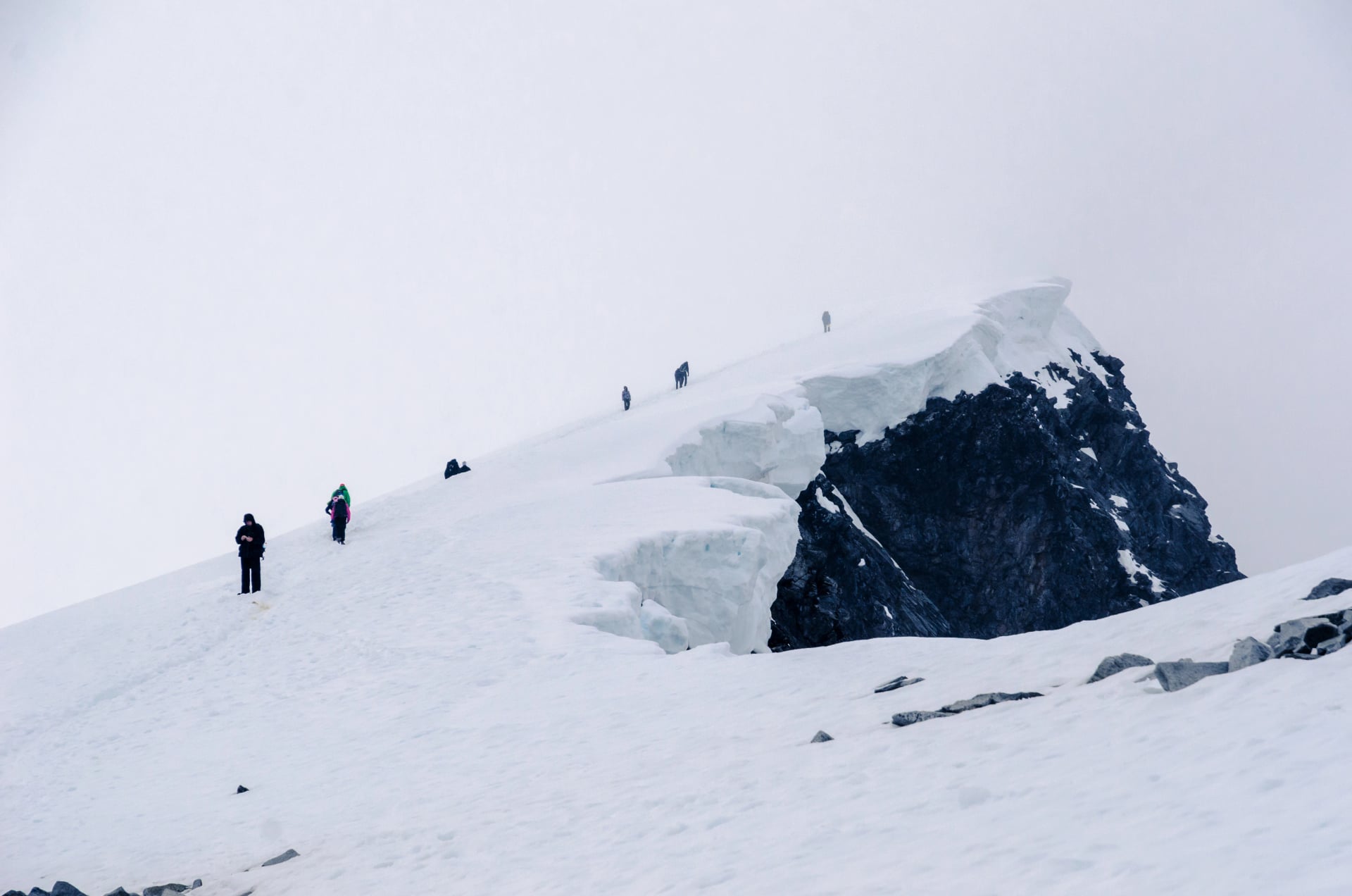
2. Galdhøpiggen (2,469 m)
Norway's highest peak is accessible to strong hikers via two main routes: the glacier-free trail from Spiterstulen, or the glacier-crossing route from Juvasshytta (guided only). The ascent is long but non-technical from Spiterstulen, following a rocky ridge with impressive views of the Jotunheimen massif.
Distance: 12 km (from Spiterstulen)
Time: 6–8 hours
Elevation: +1,400 m
Difficulty: Hard
Clear weather reveals dozens of 2,000-m peaks and expansive glacier fields.
3. Glittertind (2,465 m)
Second only to Galdhøpiggen, Glittertind is famous for its elegant snow dome and sweeping summit views. Snow often lingers on the summit ridge, making conditions variable.
Distance: 16–18 km
Time: 6–8 hours
Elevation: +1,100–1,300 m
Difficulty: Hard
Routes begin from Glitterheim or Spiterstulen, with the Glitterheim approach offering a gentler gradient.
4. Knutshøe Ridge
Sometimes called the "little Besseggen," Knutshøe is quieter but offers dramatic fjord-like scenery, airy ridge walking and panoramic views across the Gjende valley.
Distance: 12–14 km
Time: 4–6 hours
Elevation: +700 m
Difficulty: Moderate
This is an ideal alternative for hikers wanting ridge views without the crowds of Besseggen.
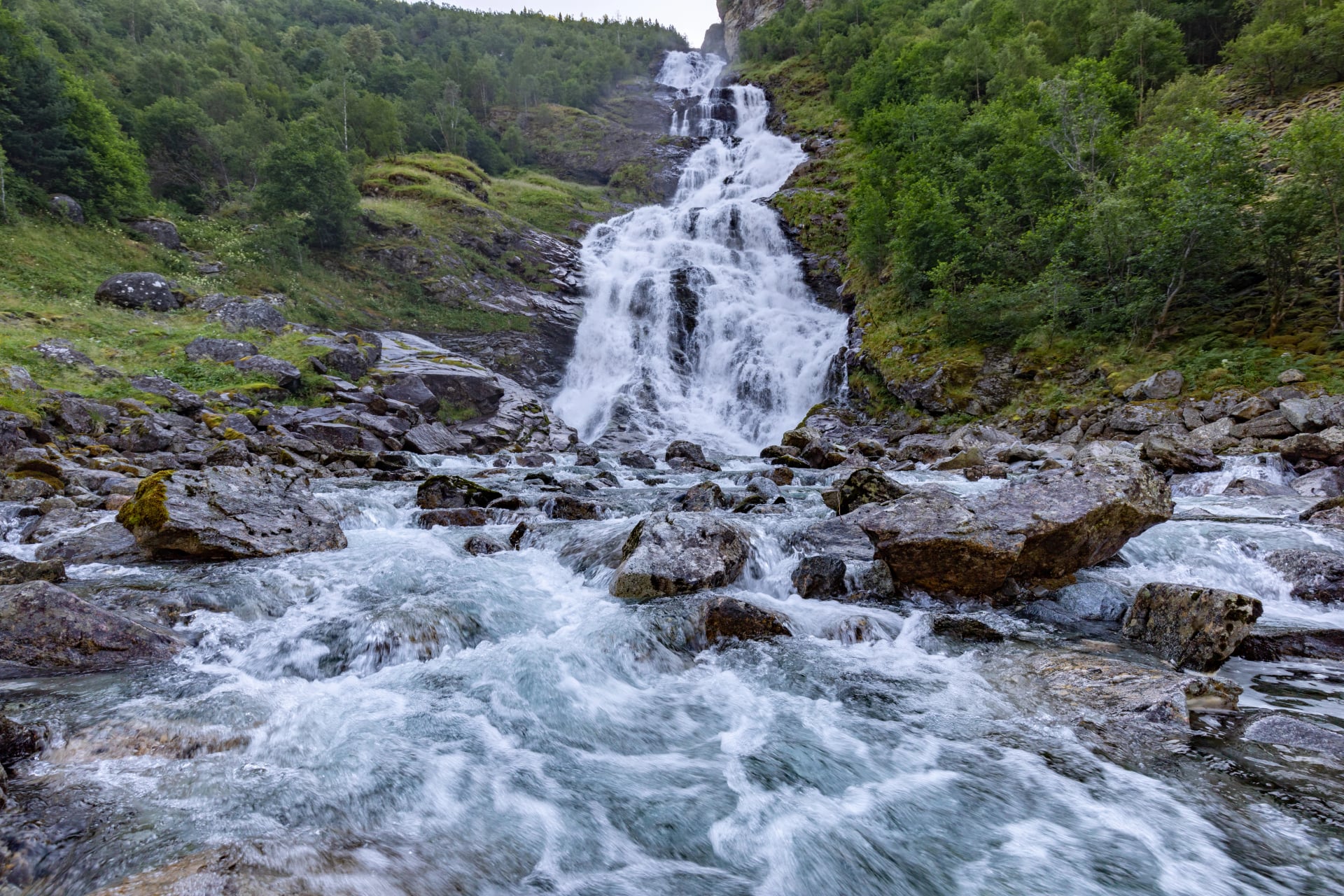
5. Utladalen & Vettisfossen
Utladalen is Norway's deepest valley, known for lush landscapes and dramatic waterfalls. The hike to Vettisfossen, one of Norway's highest free-fall waterfalls, follows a well-maintained path suitable for most hikers.
Distance: 12–15 km
Time: 4–5 hours
Elevation: +300 m
Difficulty: Moderate
This valley offers a completely different atmosphere than the high-alpine routes.
6. Gjende Lake Traverse (Memurubu → Gjendebu)
A superb point-to-point hike connecting two of Jotunheimen's iconic cabins. The trail follows rolling high terrain with constant lake views and expansive scenery.
Distance: 10–14 km
Time: 4–5 hours
Elevation: +500 m
Difficulty: Moderate
Perfect as part of a multi-day hut-to-hut route.
How Much Time Do You Need in Jotunheimen
You can visit Jotunheimen in a day, but two to four nights allows time for multiple classic routes such as Besseggen, Galdhøpiggen and Knutshøe. If you're planning several summits or a multi-day hut-to-hut trek, five to seven days is ideal.
If you want a ready-made itinerary, our guided and self-guided routes showcase the region's best hikes without any planning stress.
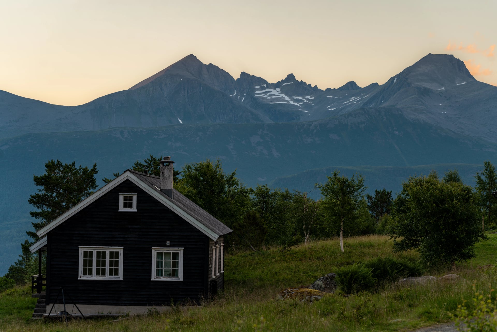
Where to Stay in Jotunheimen
Accommodation in Jotunheimen uses traditional Norwegian mountain lodges, DNT huts and a few nearby villages.
Most hikers base themselves at:
Gjendesheim – ideal for Besseggen and Gjende valley routes
Spiterstulen – perfect for ascents of Galdhøpiggen and Glittertind
Memurubu – ferry-accessed lodge midway along Gjende
Gjendebu – one of Norway's oldest mountain cabins, excellent for multi-day routes
Fondsbu – great access to western Jotunheimen
These lodges provide meals, bedding (unless noted) and a classic Norwegian mountain atmosphere. They book out quickly during summer.
Nearby villages such as Lom offer hotels, bakeries, supermarkets and shops for gear or supplies.
Mountain Huts in Jotunheimen
Jotunheimen's huts are part of Norway's DNT (Norwegian Trekking Association) system. Staffed huts operate during summer with wardens providing hot meals and bedding. Self-service huts remain open year-round but require DNT membership and key for access.
DNT membership provides 40-50% discount on hut stays. If staying 3+ nights, membership pays for itself. Members also get access to self-service huts for flexible route planning.
For detailed information about Norwegian mountain huts and DNT membership, see our complete guide to Norwegian mountain huts.
Camping in Jotunheimen
Thanks to Norway's Right to Roam (Allemannsretten), wild camping is generally allowed as long as you pitch at least 150 m from buildings and respect nature. However, inside the busiest areas of Jotunheimen—particularly near Gjende—camping is restricted to designated areas.
Important to know:
Wild camping is allowed away from lodges and infrastructure
Tents must not block trails or protected zones
Several paid campsites exist near Gjendesheim and in Lom
Weather can be severe even in summer—prepare accordingly
How to Get to Jotunheimen National Park
Most hikers access the park through Gjendesheim, Lom, or Øvre Årdal.
By Air
Nearest airports:
Oslo Gardermoen (OSL) – best international access
Bergen (BGO) – good for western approaches
Trondheim (TRD) – north-bound entry
From the airports, long-distance buses or rental cars reach Lom or Otta, the main gateways.
By Public Transport
Buses operate seasonally:
Oslo → Fagernes → Gjendesheim
Oslo/Trondheim → Otta → Lom
Bergen → Tyinkrysset → Øvre Årdal

Check timetables as schedules shift each summer.
By Car
Typical drive times:
From Oslo: 4–5 hours
From Bergen: 4–5 hours
From Trondheim: 5 hours
Mountain roads may close in early winter or spring due to snow.
How to Get Around Jotunheimen
Getting around Jotunheimen uses a combination of driving, hiking and ferry transport.
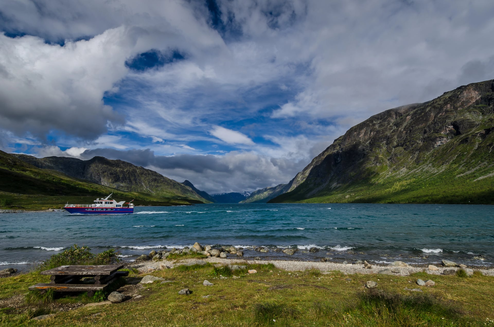
Gjende Ferry System
In summer, ferries link Gjendesheim, Memurubu and Gjendebu. This system makes classic point-to-point hikes like Besseggen or multi-day hut routes easy to plan.
Ferries run daily from late June to late September
Online booking strongly recommended
Perfect for linear hikes avoiding out-and-back routes
Driving Access
Main access points include:
Gjendesheim – parking and start of Besseggen
Spiterstulen – access to Galdhøpiggen & Glittertind
Leirvassbu – remote mountain lodge reached via toll road
Øvre Årdal – gateway to Utladalen
Parking fills early during peak season.
Public Transport
Public transport to Jotunheimen is seasonal and limited, but summer buses run from Oslo, Bergen and Trondheim to Lom, Otta and other gateway towns. From there, local shuttles connect to Gjendesheim.
Essential Packing List for Jotunheimen
Conditions vary widely depending on elevation, exposure and season. A flexible layering system is essential.
Recommended items:
Waterproof hiking boots
Trekking poles
25–35 L daypack
Warm mid-layer and insulated jacket
Waterproof jacket & trousers
Hat, gloves, buff
Sunscreen & sunglasses
Map/GPS (reception limited in high areas)
Headlamp
2–3 L water capacity
Snacks & emergency food
Power bank
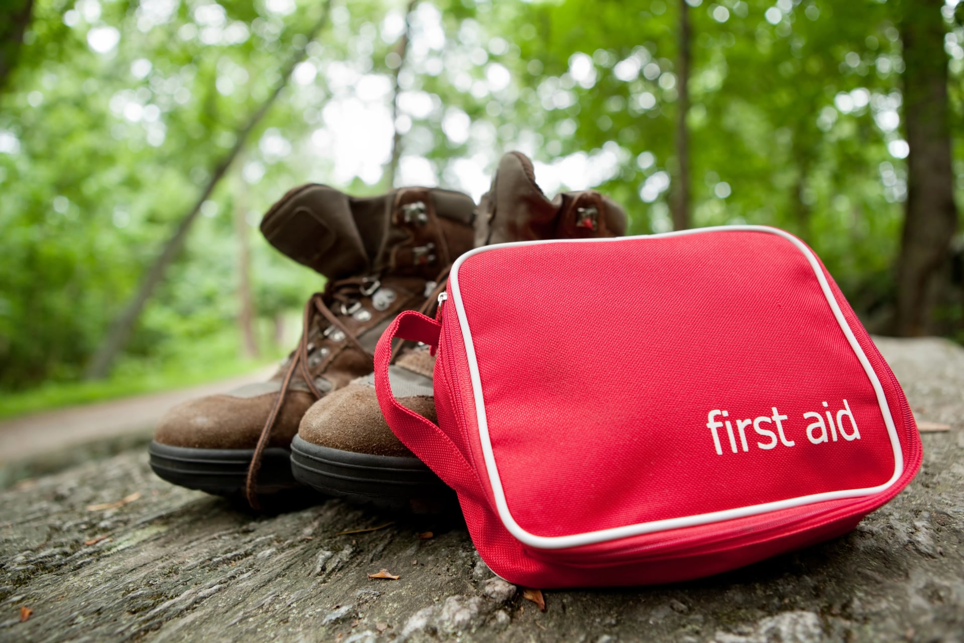
First aid kit
If you hike with us, you'll receive a detailed personalised packing guide tailored to your specific route and dates.
Emergency Numbers and Safety
Norway is safe, but mountain terrain requires preparation.
Key emergency contacts:
112 — Emergency services (police, ambulance, rescue)
Safety tips:
Check weather forecasts before starting your hike
Avoid ridges and high terrain during storms
Carry warm layers even in summer
Share your route with someone
Turn back immediately if conditions deteriorate
Visitor centres in Gjendesheim, Spiterstulen and Lom offer updated trail conditions and safety advice.
Useful Norwegian Phrases for the Trail
Hei – Hello
Takk – Thank you
Unnskyld – Excuse me / sorry
Snakker du engelsk? – Do you speak English?
Vann – Water
Tursti – Hiking trail
Hytte – Mountain cabin
Jeg er sliten – I am tired
Hvor er…? – Where is…?
God tur! – Have a good hike!
Plan Your Jotunheimen Hiking Adventure
Planning a hiking trip in Jotunheimen requires managing hut reservations, ferry schedules, changing weather patterns and route variations. If you prefer to skip the logistics and focus on enjoying Norway's most famous mountain scenery, consider one of our supported hiking trips.
We’ll help you find the perfect tour from our curated Jotunheimen itineraries—no planning stress needed.
Tell us your travel dates, and we’ll match you with the ideal Jotunheimen National Park hiking tour.


HASSLE-FREE
We handle itineraries, accommodations, and anything else you prefer not to deal with, so you can enjoy a carefree hike.

BOOK WITH CONFIDENCE
We are a financially protected company, fully bonded and insured, keeping your money safe and allowing you to travel with confidence.

TRIED & TESTED ADVENTURES
Only the best hut to hut hikes in Europe, cherry-picked by our local team with an in-depth knowledge of the region.

UNBEATABLE SUPPORT
Our 24/7 customer support is where we show our passion, bringing you a better experience by making your well-being our number one priority.