Hiking the Aurlandsdalen Valley Guide
A complete guide to hiking the Aurlandsdalen Valley, one of Norway's most scenic mountain-to-fjord trails connecting Finse to Aurlandsdalen through traditional villages.
Quick links
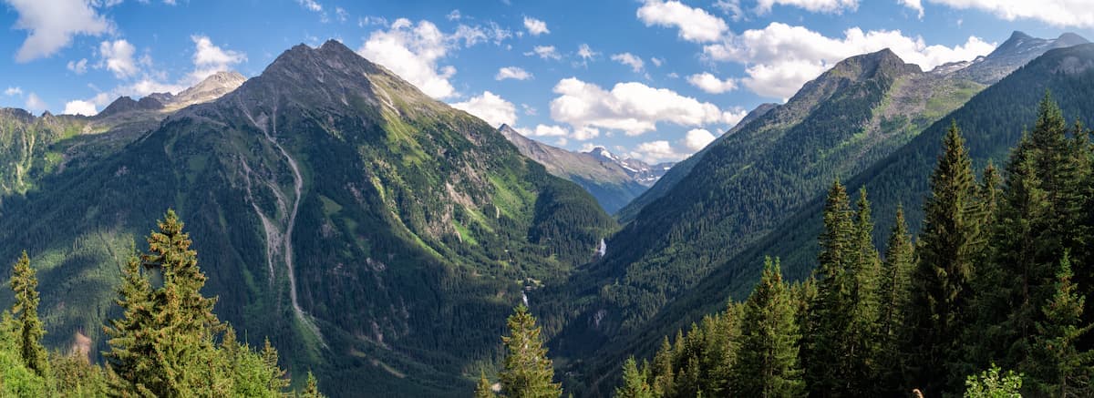
The Aurlandsdalen Valley hike is a classic Norwegian mountain trek that takes you from the high Hardangervidda plateau down through one of Norway's most beautiful valleys to the Aurlandsdalensfjord. The route covers approximately 60 kilometers over 4 days, descending from 1,222 meters at Finse to sea level at Aurlandsdalen.
This hike combines alpine plateau hiking, valley walking, and traditional Norwegian mountain culture. The trail is well-marked, uses DNT huts for accommodation, and works well for hikers with moderate experience and good fitness.

Route Overview
The standard route runs Finse → Geiterygghytta → Steinbergdalshytta → Østerbø → Vassbygdi/Aurlandsdalen and takes 4 days to complete.
Day 1: Finse to Geiterygghytta
Distance: 14–16 km
Time: 5–6 hours
Elevation: Mostly flat with some rolling terrain
Terrain: High mountain plateau, boulder fields, streams

Start from Finse station (accessible by Bergen Railway) and hike across the Hardangervidda plateau. The landscape is vast and open with views of glaciers. Geiterygghytta is a staffed DNT hut with meals and comfortable beds.
Day 2: Geiterygghytta to Steinbergdalshytta
Distance: 12–14 km
Time: 4–5 hours
Elevation: Gradual descent
Terrain: Plateau transitioning to valley
Continue across high terrain before beginning the descent into Aurlandsdalen Valley. The landscape starts to change from open plateau to more sheltered valley terrain. Steinbergdalshytta is a self-service DNT hut requiring your own food and sleeping bag.
Day 3: Steinbergdalshytta to Østerbø
Distance: 14–16 km
Time: 5–6 hours
Elevation: Continued descent
Terrain: Valley hiking, forested sections

The valley becomes more defined with steeper sides, waterfalls, and vegetation. You'll pass through an increasingly lush landscape as you descend. Østerbø is a staffed mountain lodge with excellent meals and a traditional Norwegian atmosphere.
Day 4: Østerbø to Vassbygdi/Aurlandsdalen
Distance: 17–20 km
Time: 5–7 hours
Elevation: Final descent to sea level
Terrain: Valley floor, traditional farms, road sections
The final day follows the valley floor past traditional mountain farms (stølseter), through small villages, and eventually to Aurlandsdalen on the fjord. The last section follows roads and is less scenic but straightforward. You can arrange transport from Vassbygdi to shorten the road walking.
When to Hike the Aurlandsdalen Valley
The main season runs from late June to late September, when huts are open and high-altitude snow has melted.
July–August: Peak season with best weather, all huts fully staffed, but also the busiest period. Book huts 2–3 months ahead.
September: Excellent conditions with fewer hikers, stable weather, and autumn colours. Most huts remain open through mid-September.
June and October: Possible but weather is less stable, some huts may be closed or operating on reduced schedules.

Avoid this hike before mid-June—snow and meltwater make the high plateau dangerous and difficult.
Accommodation and Booking
The route uses a mix of staffed and self-service DNT huts.
Geiterygghytta (staffed):
Meals provided (dinner and breakfast)
Bedding provided (bring sleeping bag liner)
Book via DNT website or by phone
Popular—book ahead in summer
Steinbergdalshytta (self-service):
No meals—bring all food
Mattresses only—bring sleeping bag
Kitchen facilities available
DNT membership and key required
First-come, first-served (usually space available)

Østerbø (staffed lodge):
Excellent meals and comfortable beds
Book directly through Østerbø
Often fully booked in peak season
Aurlandsdalen: Multiple hotels, guesthouses and hostels available in the village.
DNT membership recommended: Saves 40–50% on hut costs and provides access to self-service huts. If staying 3+ nights, membership pays for itself.
Difficulty and Fitness Requirements
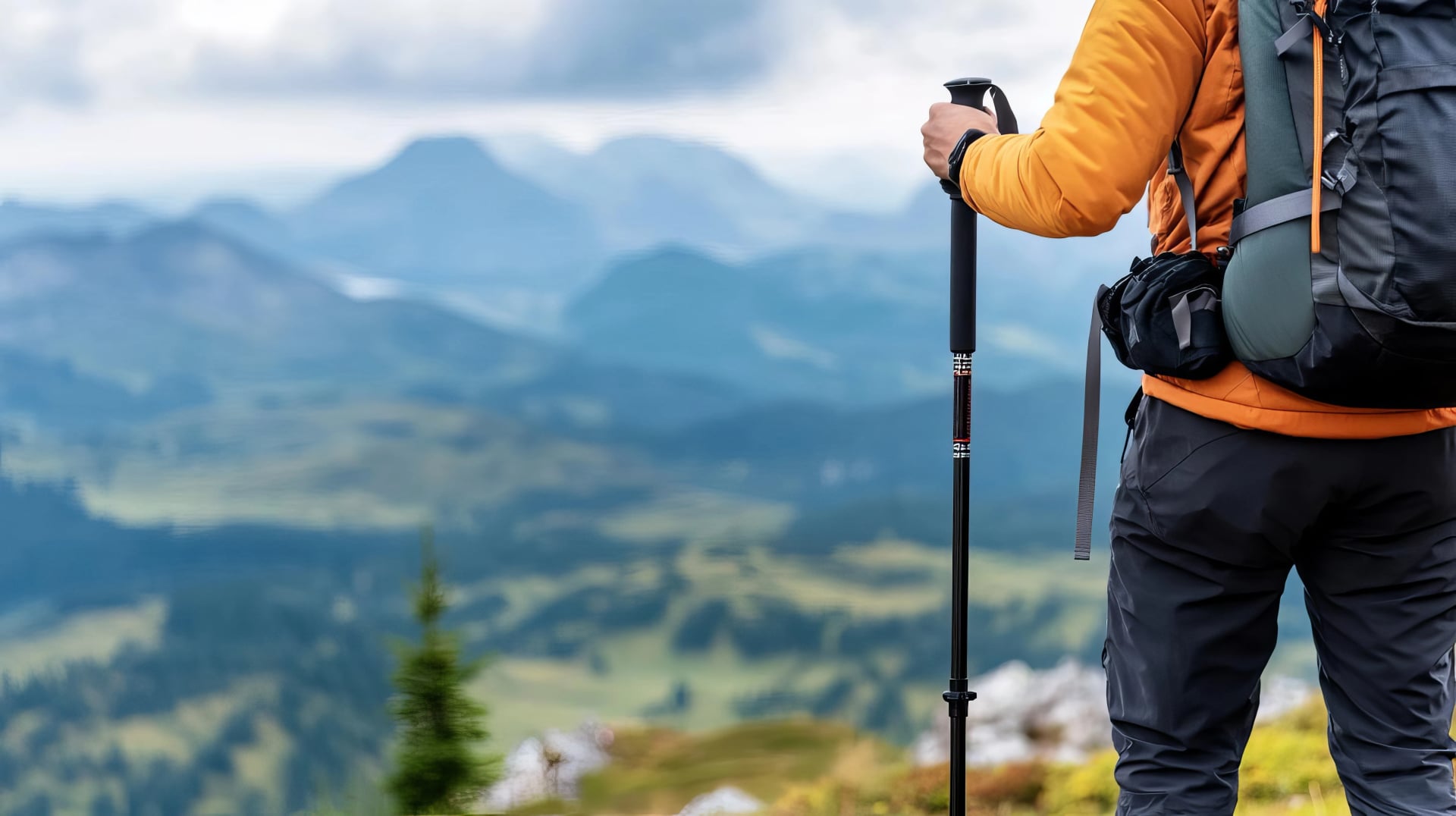
The Aurlandsdalen Valley hike is moderate difficulty and suitable for hikers with good general fitness and some mountain hiking experience.
What makes it a great hike:
Well-marked trails (red T markers)
Daily distances are reasonable (12–20 km)
Huts provide regular breaks
Mostly descent or flat terrain

What makes it challenging:
High-altitude start (weather can change quickly)
Day 1 crosses exposed plateau (wind, cold, fog possible)
Boulder fields and uneven terrain require care
Self-sufficiency needed for Day 2 (self-service hut)
Long final day (17–20 km)
If you can hike 5–7 hours with a 7–10 kg pack and handle uneven mountain terrain, you'll manage this route comfortably.
What to Pack
For staffed huts (Days 1, 3, 4):
Sleeping bag liner (mandatory)
Light hut shoes or sandals
Warm layers (fleece or down jacket)
Waterproof jacket and pants
Basic toiletries
For self-service hut (Day 2):
Full sleeping bag
All food for dinner and breakfast
Camping stove and fuel (gas canisters)
Cooking pot and utensils
Matches/lighter

Hiking essentials:
Waterproof hiking boots (broken in)
Trekking poles (highly recommended)
Hat, gloves, buff (even in summer)
Sunglasses and sunscreen
Map and compass/GPS
First aid kit
Headlamp
Water bottles (2L capacity)
Snacks and emergency food
Weather on the Hardangervidda can be severe—bring proper layers even if valley forecasts look good.
Getting to Finse and From Aurlandsdalen
To Finse (start):
Finse is accessible only by Bergen Railway (no roads). The station sits at 1,222 meters altitude.
From Oslo: Direct trains (4–5 hours)
From Bergen: Direct trains (2.5–3 hours)
Book tickets at vy.no (Norwegian railways)
Popular route—book trains early in summer

From Aurlandsdalen (finish):
Aurlandsdalen sits on the Aurlandsdalensfjord with good transport connections.
Bus to Flåm (15 minutes), then Flåm Railway to Myrdal, then train to Oslo/Bergen
Express boat to Bergen (4 hours, summer only)
Bus to Geilo or other valley towns
Rental car possible
Many hikers combine this trek with visits to Flåm, the Flåm Railway, or the Stegastein viewpoint near Aurlandsdalen.
Weather and Safety
Weather changes rapidly on the Hardangervidda plateau. Clear morning conditions can shift to wind, rain, fog or even snow (possible in June and September) within hours.
Best weather sources:
yr.no (most reliable Norwegian forecast)
Varsom.no (mountain conditions)
Ask hut wardens (they receive daily updates)
Safety tips:
Check weather before leaving Finse
Don't start in bad weather—wait at Finse for conditions to improve
Carry warm layers, waterproofs, and extra food
GPS or map essential (fog common on plateau)
Emergency number: 112
Hut wardens can advise on conditions and will always accommodate you if weather forces you to stay extra nights.
Practical Tips
Start early: Most hikers leave huts 7:30–8:30 AM to complete stages comfortably.
Pack light: Since huts provide meals (except Steinbergdalshytta), you can keep your pack under 10 kg.
Bring cash: Some huts have limited card facilities. Have 500–1,000 NOK for self-service hut and extras.
Water: Mountain streams are safe to drink throughout this route.
Midges: Can be present in valleys during warm, calm weather (July–August). Consider insect repellent.
Phone signal: Unreliable on the plateau, better in valleys. Don't rely on your phone for navigation.
Plan Your Aurlandsdalen Hiking Adventure
The Aurlandsdalen Valley hike delivers a complete Norwegian mountain experience in just 4 days. You'll cross the vast Hardangervidda plateau, descend through one of Norway's most beautiful valleys, experience traditional mountain culture, and finish at a stunning fjord.

The route is well-established, properly marked, and supported by good huts, making it accessible without being easy. It works well as a first multi-day Norwegian hut trek or as a shorter alternative to longer Hardangervidda crossings.
When you arrive in Aurlandsdalen, tired but satisfied, you'll have crossed from alpine plateau to fjord, experienced some of Norway's most dramatic landscapes, and gained a real sense of what Norwegian mountain hiking offers.
Ready to hike the Aurlandsdalen Valley?
We can help you plan your trek, book all huts, arrange transport, and create a detailed itinerary. From timing advice to gear recommendations, we handle the logistics so you can focus on hiking.
Send us your dates, and we'll create a personalised plan for the Aurlandsdalen Valley hike.


HASSLE-FREE
We handle itineraries, accommodations, and anything else you prefer not to deal with, so you can enjoy a carefree hike.

BOOK WITH CONFIDENCE
We are a financially protected company, fully bonded and insured, keeping your money safe and allowing you to travel with confidence.

TRIED & TESTED ADVENTURES
Only the best hut to hut hikes in Europe, cherry-picked by our local team with an in-depth knowledge of the region.

UNBEATABLE SUPPORT
Our 24/7 customer support is where we show our passion, bringing you a better experience by making your well-being our number one priority.